
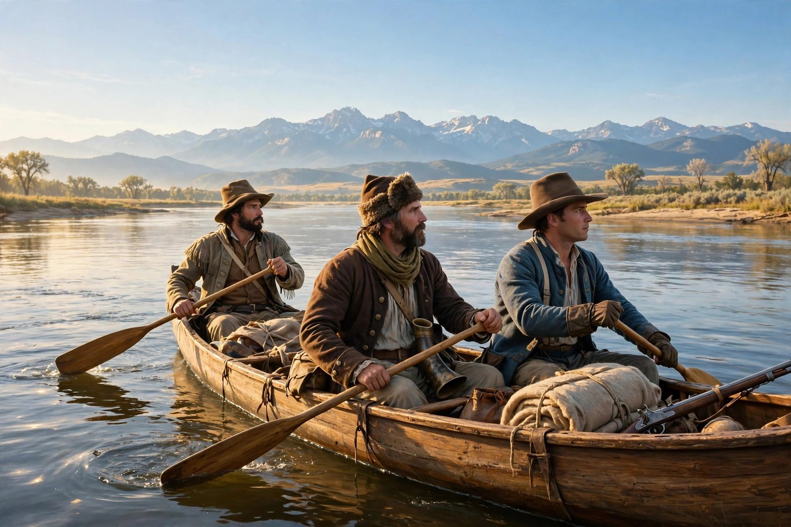
In November 1805, after more than a year of paddling, marching, and climbing, a small band of American explorers stood on the edge of the Pacific Ocean. William Clark opened his journal and wrote, in his own rough spelling, “Ocian in view! O! the joy.” It was one of the most famous sentences in American history. The Lewis and Clark Expedition, known to its members as the Corps of Discovery, had set out from near St. Louis in May 1804 to explore a vast new territory that most Americans had never seen. By the time the party returned home in September 1806, its members had traveled roughly 8,000 miles, crossed the Rocky Mountains, mapped great rivers, met dozens of Native nations, and brought back a treasure of scientific knowledge that changed how the young United States understood its own continent.
Every November, as the anniversary of that Pacific arrival comes around, the journey is worth retelling as the long, human adventure it really was. The expedition was cold, hungry, wet, and often frightened. Its members got lost, fell sick, and nearly starved in the mountains. They also traded, made friends, kept careful journals, and pressed on when turning back would have been far easier. This is the story of how they did it, who helped them, and why the months they spent on the Pacific coast still matter today.
Jefferson’s Bold Gamble After the Louisiana Purchase
The expedition began with a president who loved maps and science. In 1803, the United States completed the Louisiana Purchase, buying a huge stretch of land from France that roughly doubled the size of the young nation. Almost overnight, the country stretched from the Mississippi River toward the Rocky Mountains, but nobody in Washington really knew what was out there. There were no reliable maps of the upper Missouri River, no clear picture of the mountains to the west, and no answer to the question every explorer had asked for generations: was there a practical water route across the continent to the Pacific? President Thomas Jefferson wanted answers from people he trusted to observe carefully and write everything down.
Jefferson chose his personal secretary, Captain Meriwether Lewis, to lead the expedition, and Lewis invited his friend William Clark to share command. Their instructions were broad and ambitious: explore the Missouri River, find the best route to the Pacific, map the country, record its plants, animals, and weather, and build friendly relations with the Native peoples they met. They were also to look for trade opportunities, because Jefferson hoped American commerce would one day follow the explorers’ trail. Preparation took months. Lewis bought surveying instruments, rifles, medicines, and trade goods such as beads, knives, and tobacco, while Clark gathered the men at a winter camp near St. Louis. The party carried its food and tools in a 55-foot keelboat and two smaller boats called pirogues, along with Lewis’s Newfoundland dog, Seaman. You can read the National Park Service account of the expedition on the National Park Service Lewis and Clark page.
Setting Out From St. Louis in May 1804
On the afternoon of May 14, 1804, the Corps of Discovery pushed off from Camp Wood, also known as Camp Dubois, on the Illinois side of the Mississippi near its meeting with the Missouri. The party numbered about 45 men at departure, although only about 33 of them would make the full journey to the Pacific and back. Some men were sent back with messages and specimens, others joined along the way, and the permanent party that crossed the mountains was a smaller, tighter group. The boats moved slowly upstream against the Missouri’s powerful current, and the men spent their days rowing, poling, and towing the keelboat from the bank with ropes. Progress was measured in miles, and every mile had to be earned.
The first summer brought both wonder and loss. The men hunted deer, elk, and buffalo on the open plains and kept journals that would become the expedition’s lasting gift to history, recording the weather, the river’s course, and the people they met. But in August 1804, the expedition suffered its only death. Sergeant Charles Floyd fell gravely ill, probably with appendicitis, and died near present-day Sioux City, Iowa. His comrades buried him on a bluff above the river with military honors. The loss was a sober reminder that the journey was dangerous. Yet the party pressed on, reaching the Mandan villages in present-day North Dakota by late autumn, where they would spend the winter.
Winter at Fort Mandan and the Arrival of Sacagawea
The winter of 1804 to 1805, spent at Fort Mandan near the Mandan and Hidatsa villages, was one of the most important chapters of the whole expedition, even though the party barely moved. The captains built a log fort, traded with their Native neighbors, and hired the people who would make the next stage possible. Among them was a French Canadian fur trader named Toussaint Charbonneau, hired as an interpreter, and his young Shoshone wife, Sacagawea. She was only a teenager, and she was pregnant when she joined the expedition, yet she would become one of its most important members. She spoke Shoshone and Hidatsa, and her knowledge of languages and Native customs proved invaluable. She also carried her infant son, Jean Baptiste, who was born during that winter at Fort Mandan, on the journey that followed. Her presence as a woman with a baby helped signal to the peoples the party met that the expedition came in peace.
It is easy to repeat the old myth that Sacagawea was the expedition’s guide, pointing the way step by step to the Pacific. The real story is more interesting. Her greatest contribution came in August 1805, when the expedition desperately needed horses to cross the Rocky Mountains. Sacagawea recognized landmarks near the Three Forks of the Missouri River, helped the captains locate the Shoshone, and discovered that their leader, Cameahwait, was her brother. That family reunion opened the door to friendship, trade, and the horses the expedition could not have done without. She also saved the journals and scientific records when a boat capsized in May 1805, calmly rescuing papers that would otherwise have been lost to the river. Historians today describe her as an interpreter and diplomat, and that is praise enough.
Crossing the Rockies With Shoshone Horses
By August 1805, the expedition had reached the headwaters of the Missouri and faced the question that would decide everything: how would they get over the Rocky Mountains? Lewis crossed the Continental Divide at Lemhi Pass on August 12, 1805, and discovered, to his disappointment, that there was no easy water route through the mountains. Instead, there were more ranges, deep valleys, and rivers running in the wrong direction. The only way forward was on foot and on horseback, and that meant the Shoshone horses were not a luxury but a necessity. Through Sacagawea’s interpreting and the friendship of Cameahwait, the expedition obtained horses and a guide, and set out across the Bitterroot Mountains in September 1805. It was the hardest stretch of the entire journey. Food ran short, the trail was steep, snow fell early, and the men were cold and exhausted by the time they reached the Nez Perce villages on the far side.
The crossing taught the expedition a hard lesson about the American West: the mountains were far wider and more difficult than anyone in Washington had imagined, and the dream of a simple river highway to the Pacific was just that, a dream. What the captains found instead was a continent of great rivers running in different directions, separated by high ranges that could only be crossed with local knowledge and strong help from Native peoples. That discovery was itself a major achievement, because it replaced guesswork with real knowledge. Once across the mountains, the party built dugout canoes and paddled down the Clearwater, the Snake, and finally the great Columbia River toward the sea. By late October and early November 1805, they could feel the change in the air and sense that the end of the outward journey was near.
Reaching the Pacific in November 1805
On November 7, 1805, William Clark wrote the joyful words that have echoed through American history ever since: “Ocian in view! O! the joy.” The expedition had reached the mouth of the Columbia River and could see the Pacific Ocean. According to the National Park Service, the party had arrived at the place they had longed to reach. The days that followed were not a simple celebration, however. The weather on the coast was stormy and wet, the party moved from camp to camp along the banks of the Columbia, and it took time to find a safe place to spend the winter. On November 15, the wind calmed enough for the party to move to a better camp, and Clark led a small group to Cape Disappointment and the sea beach beyond, while Lewis met Native leaders and traded for food.
The most remarkable moment of that November came on November 24, 1805, when the captains held a vote to decide where to spend the winter. Every member of the party was given a voice, including Sacagawea and York, Clark’s enslaved manservant. That democratic vote, held on the far edge of the continent by a military expedition in 1805, still stands out as an extraordinary event. The vote favored crossing to the south side of the Columbia River, where the party hoped to find better shelter and more game. They found a site along the Netul River, now called the Lewis and Clark River, near present-day Astoria, Oregon, and began building their winter home there. The story of that winter is told in detail by the Lewis and Clark Trail Fort Clatsop page. Reaching the Pacific also gave the United States a real, documented presence on the coast, and it strengthened the young nation’s later claim to the Oregon country.
Winter at Fort Clatsop and the Long Road Home
Fort Clatsop, named for the Clatsop people whose homeland it stood in, was the expedition’s home from December 1805 to March 1806. Construction began in early December, and the party moved into the roughly 50-foot-square log fort on Christmas Day. It was not a comfortable winter. During the 106 days the party spent at Fort Clatsop, it rained on all but 12 days, and only a handful of days brought sunshine. The men were plagued by fleas and colds, their elk meat spoiled in the wet weather, and their clothes rotted faster than they could be repaired. Yet the winter was also a time of intense work. The captains wrote up their journals, drew maps, recorded notes on the plants, animals, and Native peoples of the Pacific coast, and prepared for the return journey. They traded with local tribes and made salt at a camp near present-day Seaside, Oregon.
The expedition left Fort Clatsop on March 23, 1806, giving the fort to Clatsop Chief Coboway as a gesture of friendship. The return journey was long and difficult, with the party fighting strong currents up the Columbia, waiting for mountain snows to melt, and splitting into two groups to explore more country on the way home. Lewis took a northern route and Clark a southern one, and the two groups reunited near the mouth of the Yellowstone River in August 1806. Along the way, Sacagawea helped Clark find a shortcut through Bozeman Pass to the Yellowstone River. The party said goodbye to Sacagawea, Charbonneau, and young Jean Baptiste at the Mandan villages in August, then hurried down the Missouri as the river carried them home.
On September 23, 1806, the Corps of Discovery arrived back in St. Louis, two years, four months, and nine days after it had set out. The men had traveled more than 8,000 miles, lost only one member, and brought back journals, maps, and specimens that would shape American knowledge of the West for generations. The History.com account of the departure notes that the expedition returned with a wealth of information about a region already home to many Native peoples, as well as valuable claims that would later support the United States in the Oregon country. Today, visitors can walk the ground where the expedition wintered at Lewis and Clark National Historical Park near Astoria, Oregon, and see a reconstruction of Fort Clatsop. The National Park Service preserves the story of the fort on its Fort Clatsop archaeology page. The explorers did not find the easy water route Jefferson had hoped for, but they found something just as important: the truth about the continent, written down day by day, mile by mile, all the way to the Pacific and back.
FAQ
When did Lewis and Clark reach the Pacific Ocean?
The expedition first saw the Pacific Ocean on November 7, 1805, when William Clark wrote “Ocian in view! O! the joy” in his journal. The party was then at the mouth of the Columbia River, and it spent the rest of November moving to winter quarters on the Oregon side of the river.
How long did the Lewis and Clark Expedition last?
The expedition left Camp Wood near St. Louis on May 14, 1804, and returned to St. Louis on September 23, 1806. That is a journey of two years, four months, and nine days, covering roughly 8,000 miles in total, including the return trip and side journeys.
Who was Sacagawea and why was she important?
Sacagawea was a young Lemhi Shoshone woman who joined the expedition at Fort Mandan with her husband, Toussaint Charbonneau, as an interpreter. She helped the captains communicate with Native peoples, recognized landmarks that led them to the Shoshone, and helped obtain the horses needed to cross the Rocky Mountains. She also saved the expedition’s journals when a boat capsized.
Where did Lewis and Clark spend the winter of 1805-1806?
They spent the winter at Fort Clatsop, a log fort built near present-day Astoria, Oregon, on the south side of the Columbia River. The party lived there for 106 days, from December 1805 to March 23, 1806, enduring almost constant rain while writing journals, drawing maps, and trading with local tribes.
What did the expedition discover and bring back?
The expedition mapped the Missouri and Columbia rivers, proved that no easy water route crossed the continent, documented many plants and animals, and recorded detailed information about dozens of Native nations. The captains brought back journals, maps, and specimens that gave the United States its first reliable picture of the West and strengthened its claim to the Pacific coast.