
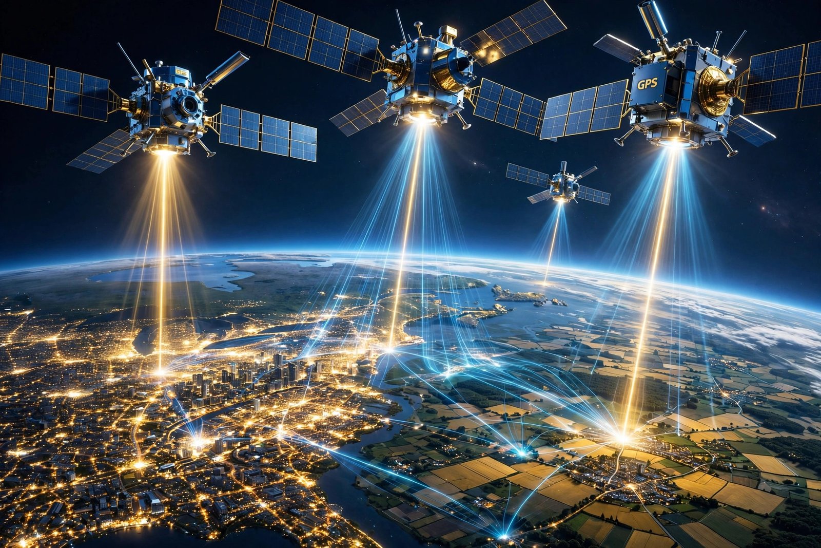
Right now, as you read this, a constellation of American satellites is telling your phone exactly where you are, to within a few feet, anywhere on Earth, for free. It guides airplanes to runways in fog, helps farmers plant in perfectly straight rows, times the stock market and the power grid, and directs soldiers, sailors, and rescue teams with precision that would have seemed like magic a generation ago. That system is GPS, the Global Positioning System, and it is one of the most consequential things the United States has ever built — a military project that became, quietly, the invisible infrastructure of the modern world.
GPS is a space-based radio-navigation system owned by the United States government and operated by the U.S. Space Force. It provides position, navigation, and timing information to anyone with a GPS receiver, anywhere on or near the Earth, without requiring the user to transmit any data and without needing telephone or internet reception. It is free for civilian use worldwide, and it is used by billions of people every day, most of whom never think about where it came from. This is the story of how it was built, how it works, and why it remains a distinctly American form of power.
From Sputnik to NAVSTAR
GPS has its origins in the Sputnik era. When the Soviet Union launched the world’s first artificial satellite in 1957, American scientists noticed that they could pinpoint the satellite’s location from shifts in its radio signal, known as the Doppler effect, as the wavelengths stretched and contracted with the satellite’s motion. That observation became the foundational idea for satellite navigation: if you can track a satellite from the ground by its signal, you can reverse the process and let a receiver on the ground find itself from satellite signals.
In the 1960s, the U.S. Navy deployed the Transit satellite system, the first operational satellite navigation system, used mainly by submarines. But Transit was slow and limited, giving a position only intermittently. In the early 1970s, the Department of Defense wanted a robust, stable, always-available system, and in 1973, under Air Force Colonel Bradford Parkinson, the lead architect of the GPS program, the military committed to building one. The first Navigation System with Timing and Ranging, or NAVSTAR, satellite was launched in 1978, just 44 months after the program was approved. The full constellation of 24 satellites became operational in the early 1990s, with full operational capability declared in April 1995.
The system was designed for war, and war proved its value. The Gulf War in 1991 was the first conflict in which the military used GPS in combat at scale, and it transformed desert warfare: units that once navigated by compass and map could now know their position in featureless terrain, coordinate movements precisely, and guide weapons accurately. The war made GPS famous inside the military, and it set the stage for the system’s second life as a civilian utility.
How GPS actually works
GPS works through trilateration, a form of triangulation using distance rather than angles. The system has three parts. The space segment is a constellation of at least 24 satellites — today more than 30 operational — distributed in six orbital planes, inclined 55 degrees from the equator, in medium Earth orbit at about 20,200 kilometers, or roughly 12,550 miles, above the Earth, circling the planet every 12 hours. Each satellite carries redundant atomic clocks, the most precise timekeepers ever flown, and transmits its position and the exact time at regular intervals.
The control segment is a network of stations on Earth that monitor the satellites, track their orbits, and update their clocks and position data. The user segment is every GPS receiver on Earth: phones, cars, airplanes, ships, tractors, watches, and weapons. A receiver listens for signals from at least four satellites, measures how long each signal took to arrive, multiplies that time by the speed of light to get the distance to each satellite, and calculates its position from the intersection of those distances. Four satellites give a three-dimensional position — latitude, longitude, and altitude — plus a correction for the receiver’s own clock error. The whole calculation takes seconds, and it repeats continuously as the receiver moves.
The accuracy is remarkable for a system built in the 1970s. Standard civilian service provides position accuracy to within a few meters, and modern receivers, using additional signals and corrections, can do far better — the newest systems can pinpoint a position to within less than a foot under good conditions. The timing is even more precise: GPS provides time to the 10-nanosecond level, which is why it underpins systems that have nothing to do with navigation, from cell phone networks to financial trading to the synchronization of the power grid.
From military secret to civilian utility
GPS was limited to military use until the 1980s, and its opening to civilians came from tragedy. In 1983, a Korean airliner strayed off course due to navigational errors and was shot down by Soviet fighters. President Ronald Reagan then made GPS available to the world for civilian use, a decision that changed the system’s destiny. In 1996, President Bill Clinton issued a policy directive declaring GPS a dual-use system, managed as a national asset for both military and civilian users.
For years, civilian accuracy was deliberately degraded by a feature called Selective Availability, which added error to the civilian signal. On May 2, 2000, Selective Availability was discontinued, and civilian users worldwide suddenly received a far more accurate signal. The effect was immediate and enormous: the first GPS-enabled cell phones appeared in 2004, in-car navigation became a mass product, and within a decade, GPS was in every smartphone, guiding not just drivers but runners, hikers, delivery workers, and emergency responders.
Today, GPS has two levels of service. The Standard Positioning Service is available free worldwide to any civilian receiver. The Precise Positioning Service, using encrypted signals, is restricted to the U.S. armed forces, federal agencies, and selected allied armed forces and governments. The military retains control of the system, and in a conflict it can degrade or deny civilian signals regionally, though it has strong incentives not to, given how deeply the global economy depends on GPS. That dependence is itself a form of American power: the world runs, in part, on a system the United States owns and operates.
What GPS powers today
The list of what GPS powers is so long that it is easier to notice when it is missing. Aviation uses GPS for en-route navigation and for precision approaches to runways in poor weather. Maritime shipping uses it to navigate oceans and to guide ships into port. Agriculture uses it for precision farming: tractors guided by GPS plant, spray, and harvest in perfectly straight rows, reducing waste and increasing yields. Surveying, construction, and mining use it to map and measure with centimeter precision.
Emergency services use GPS to locate callers and dispatch help to exact addresses, and search-and-rescue teams use it to coordinate in wilderness and at sea. Scientists use GPS to measure tectonic plate movement, track glaciers, monitor sea level, and study the atmosphere. Financial markets use GPS timing to timestamp trades. Power grids use it to synchronize generators. And ordinary life uses it constantly: ride-hailing, food delivery, fitness tracking, and the blue dot on the map that tells you where you are in an unfamiliar city all depend on GPS, usually without the user ever knowing the system’s name.
The economic value is staggering, though hard to measure precisely, because GPS is a free input into countless industries. Studies have repeatedly found that GPS generates hundreds of billions of dollars in economic value and that a prolonged GPS outage would disrupt aviation, shipping, agriculture, and emergency services within hours. It is, in the truest sense, critical infrastructure — and it is infrastructure that one country built and gives away.
Competition, and why GPS still leads
GPS is no longer the only global navigation satellite system. Russia operates GLONASS, Europe operates Galileo, and China operates BeiDou, and modern receivers typically use several constellations at once for better accuracy and resilience. That competition is healthy, and it reduces the risk of any single system failing. But GPS remains the standard against which the others are measured, the system built into the most devices, and the one whose signals are the most widely used worldwide.
The United States continues to modernize GPS. As of March 2026, 21 GPS satellites broadcast the newer L5 civilian signal, considered pre-operational until a full complement of 24 satellites broadcasts it, expected in 2027. The L5 signal, designed for safety-of-life applications such as aviation, offers better accuracy and resistance to interference. Newer GPS III satellites, launched since 2018, bring stronger signals, better clocks, and improved resistance to jamming and spoofing — a growing concern as adversaries develop electronic warfare capabilities.
The strategic logic has not changed since the 1970s: a nation that can tell everyone, precisely, where they are, holds a unique kind of power. It is soft power and hard power at once — a gift to the world that also serves American interests, a military system that became a civilian utility, and a reminder that the most consequential American inventions are not always the loudest ones. GPS does not announce itself. It just works, everywhere, all the time, telling a phone in a pocket exactly where on Earth it is.
Frequently asked questions
Who owns and operates GPS?
GPS is owned by the United States government and operated by the U.S. Space Force. It is freely accessible to anyone with a GPS receiver, anywhere in the world.
When did GPS become fully operational?
The first NAVSTAR satellite launched in 1978, the 24-satellite constellation became fully operational in 1993, and full operational capability was declared in April 1995.
How accurate is GPS?
Standard civilian service provides accuracy within a few meters, and modern receivers with additional signals and corrections can achieve accuracy within less than a foot under good conditions. GPS timing is accurate to the 10-nanosecond level.
Is GPS free to use?
Yes. The Standard Positioning Service is available free worldwide to any civilian receiver. The encrypted Precise Positioning Service is restricted to the U.S. military, federal agencies, and selected allies.
Related reading
For more on American institutions and infrastructure, read the hidden stories and numbers of the U.S. Capitol Building, how national parks power gateway town economies, and the Pony Express and the evolution of American navigation.
Sources for this article include NASA’s GPS overview, the U.S. Department of War’s GPS explainer, and the Global Positioning System overview.